
Hamilton Lakes and Kaweah Gap, California
Distance: 40.00 miles
Elevation Gain: 11062 ft
Elevation Loss: 11034 ft
Sequoia National Park: Crescent Meadow > Bearpaw Meadow Bearpaw Meadow > Hamilton Lake > Kaweah Gap > Hamilton Lake Hamilton Lake > Crescent Meadow
Hiking
Bikepacking

Jasper Lake, Colorado
Distance: 4.00 miles
Elevation Gain: 2000 ft
Elevation Loss: 50 ft
I wanted to get out for the peaking colors here in Colorado as I am going to Aruba the following weekend. Usually my girlfriend joins but she has a golf tournament. Originally I was going to do the Kings Lake > Devils Thumb pass > Jasper lake loop but rain and snow were in the forecast which I just wasn't feeling this time around. So I opted to go Friday after work and return this morning.
Backpacking
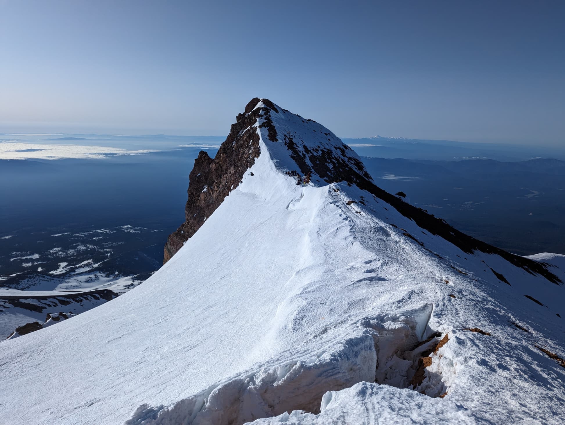
Mt. Shasta, California
Distance: 11.50 miles
Elevation Gain: 7420 ft
Elevation Loss: 7420 ft
Overnight climb up Mt. Shasta via Avalanche Gulch
Hiking
Backpacking
Mountaineering

Cooper Canyon Trail Camp, California
Distance: 5.80 miles
Elevation Gain: 1376 ft
Elevation Loss: 1376 ft
Quick first overnight backpacking trip with a toddler to Cooper Canyon Trail Camp in the Angeles National Forest and Pleasant View Ridge Wilderness.
Hiking
Backpacking

Lake of the Angels, Washington
Distance: 7.30 miles
Elevation Gain: 3302 ft
Elevation Loss: 33 ft
Out and back to Lake of the Angels
Hiking
Backpacking

High Sierra Trail (HST), California
Distance: 15.70 miles
Elevation Gain: 3500 ft
Elevation Loss: 6600 ft
High Sierra Trail (HST) report for day five of five.
Hiking
Backpacking